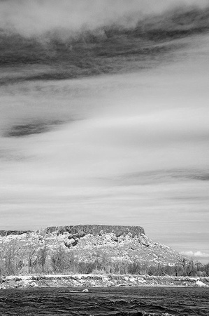
Lower Table Rock
This distinctive butte in the central Rogue Valley rises more than 2,000 feet over the north side of the river. The Takelma people had populated its slopes and surroundings for thousands of years before the sudden in-rush of gold seekers and settlers in the early 1850s permanently disrupted their way of life. An historic peace treaty was negotiated here in 1853 by Gen. Joseph Lane, the first governor of the Oregon Territory, ending a month of open warfare between the natives and newly arrived miners and settlers. The treaty formed the first Indian reservation in the West on about 100 square miles around Lower and Upper Table Rocks, where some of the Rogue tribes moved on the promise of protection from the U.S. Army. Other bands remained in their home territories, where they continued to endure, and perpetrate, depredations, mostly involving miners.